Grafschaft Bentheim relies on tourinfra
News archive
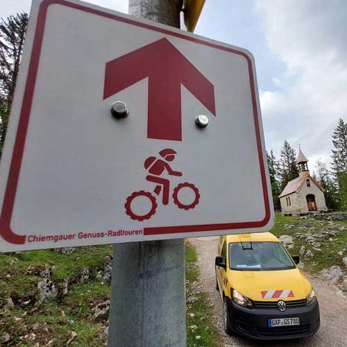
QM management bike and MTB in Chiemgau by green-solutions

Naturpark Altnühltal relies on tourinfra to manage its hiking infrastructure.

Successful completion of a hiking and cycling project in the ILE Frankenpfalz

Perfect trail conditions at the Engadin Ski Marathon!

Forward-looking planning – interface between tourinfra & digitize the planet

Highlights from the diverse hiking options in the Arberland

A 45 km network of trails has been optimized and the total number of trails now covers an impressive 110 km for cross-country skiers.
Successful completion of a hiking project by green-solutions: standardized signage according to DAV specifications in record time.

In the southern district of Bad Tölz-Wolfratshausen, a cross-municipal hiking trail concept provides more orientation.